|
|
Rock & Gold Lakes up-and-back SHORT HIKE 4.2 miles 700' elevation gain season: Jul-Oct (but not if snow below 6500') Maps (May 2020 edition)
This is a lovely hike to two lakes, and presents the hiker with classic mountain scenery. For Californians accustom to ascending to high elevations to find glacially carved lake basins it may be surprising to find them here at only 6000'. This is a few miles from the northern boundary of the Sierra Nevada and it snows a lot, so glaciers were lower during the last ice age than in most of the Sierra. The closest current glaciers are on Mount Shasta.*
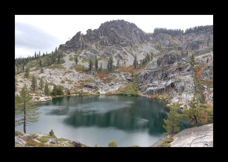
There is room for a couple of cars to park at the end of the rough dirt road at Silver Lake. One could park 1/2 mile away, at the junction with a good gravel road. Either way, head east along the Silver Lake dam, past a faint side trail along Silver Lake shore, and up an open, brushy ridge composed glacial moraine boulders and gravels. At 1.1 miles take the rocky trail to the left across slippery granite to a fine view down on Gold Lake. There is an open campsite nestled in the rocks fairly high above the lake.
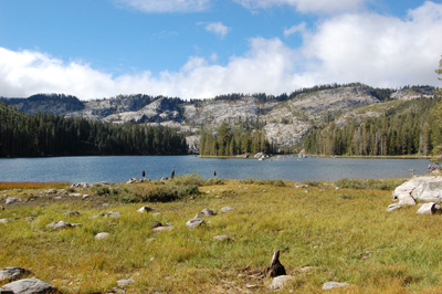
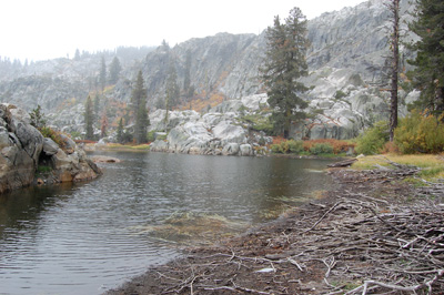
When done enjoying the view return to the trail junction, and this time take the other branch uphill past Mud Lake to another junction. Go left again and shortly you arrive at Rock Lake, with its more sheltered campsite. We generally drink the lake water without treating it; make your own judgment. Cows are common elsewhere in the Bucks Lake Wilderness, but not here. When done, return to Silver Lake Trailhead *(take the trail 2 miles
up to the ridge and turn right on the Pacific Crest Trail, 250
miles).
|
 Avenza version
 Adobe PDF version